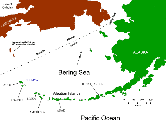
Shemya
Shemya is the largest of the Semichi Island group of the Aleutian Islands. If you look at a map it is the fifth island from the western end of the chain. Located at 52° 43" North and 174° 7" East, Shemya is actually on the other side of the International Date Line from the rest of the United States, but the IDL was bent to avoid problems.
A filmmaker looking for a location to make a movie about a natural disaster would be hard pressed to find a better candidate.
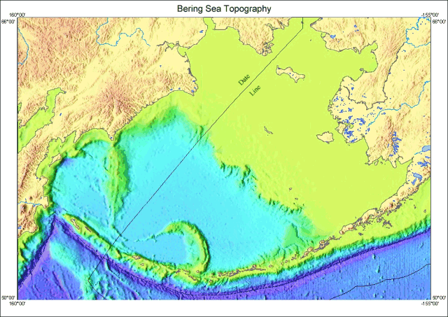
The Aleutian Islands are the tops of a ridge of volcanoes that demark the northern boundary of the "Rim of Fire" that runs up the West coast of the United States and then down the Kamchatka Peninsula through the islands of Japan.
The purple stripe running South of the ridge is the boundary between the plates. It is a 20,000-foot deep trench caused by the Pacific plate pushing under the Bering Sea plate.
Shemya was caught by a 35-foot tsunami caused by 8.7 earthquake centered near Amchitka in February of 1965.
As if the potential of tidal waves, flowing lava, and the clash of tectonic plates aren't enough, the Aleutians are the boundary between the Bering Sea Low and the North Pacific High weather systems which can provide a foot of snow, dense fog, and two inches of rain accompanied by gale force winds on the same day.
The highest recorded wind speed in the state of Alaska, 139 miles per hour, was recorded on Shemya, and the wind only drops below 30 miles per hour during June and July.
The air temperature remains fairly constant throughout the year, averaging 39° Fahrenheit. In Summer it approaches 50°, but it only goes down to 30° during the Winter. There is a minimal difference between the high and low temperature on any given day.
South of Shemya the prevailing ocean current will take you West, while the current will take you East in the waters off the North coast.
The water temperature is in the thirties. If you fall in you will not have time to drown, as hypothermia will seal your fate. In water this cold your body will sink and never come back to the surface.
The same waters are also the source of nutriments for a large range of marine life, including sea otters, seals, and other marine mammals, providing a reason for humans to come to Shemya for centuries to harvest the abundance. There are paleo-Indian artifacts found on the island indicating at least hunting camps, if not permanent settlements, by the Aleuts more than a millennium before Vitus Bering "discovered" the islands in 1741 for Elizabeta, Tsarista of All the Russias.
Bering died in December, 1741 of scurvy on Bering Island, largest of the Komandorsky Islands. His namesake is only 400 miles from Shemya.
The mice and Arctic foxes found on the island were brought by Russians. The mice live off the Tundra mosses and lichens, while the foxes live off the mice and birds. There was a dog on the island while I was there, but it is not a good place for a domesticated animal.
An amazing variety of birds live or pass through the Aleutians, and serious "birders" with a sense of adventure might consider a visit. Such a trip should only follow serious training and the purchase of high quality camping and survival gear.
After the Japanese advance into the Aleutians in World War II, the western Aleutians came to the attention of the War Department of the United States. This was the genesis of my personal involvement with Shemya.
![]()
![]()
![]()